Figure 1: The team
Introduction
It is said that the journey of a thousand kilometres starts with a single step. On the 13th of March 2023, we journeyed to Kieni forest for a three-day data collection exercise and for us, that saying was as literal as it sounds.
Our aim was to collect stereoscopic images of randomly sampled trees which we would use to build a system that employs scientific methods to estimate the biomass of a tree and consequently approximate the biomass of the whole forest. A stereoscopic image is a type of image that creates the illusion of depth and three-dimensionality by presenting two slightly different perspectives of the same scene to each camera. The two perspectives are typically captured using two cameras that are positioned a fixed distance apart, simulating the way that our eyes see the world from slightly different angles.
Apart from the stereoscopic image captures, we were also collecting the ground truth measurements to later benchmark with what the system would give as output. During our 3 days stay, we were able to collect a total of 315 images and their corresponding ground truth labels. So, the next probable million-dollar question is, how did we do it?
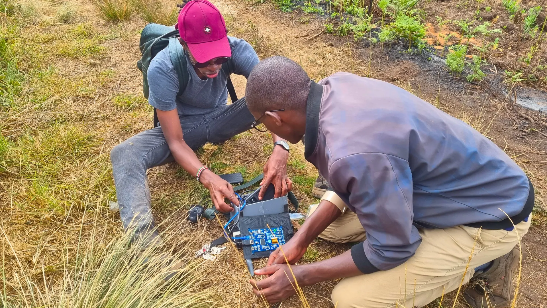
Figure 2: Some minutes after Murphy's law was in action
The System
We have built a software called “Fusion” which is able to stream inputs from two cameras and by the press of a button, it saves the two timestamped images, left and right, onto the storage device. This was the first time we were taking it out for a spin, on the first day, Murphy’s law was in control and we were its loyal subjects. However, from the second-day things were a lot smoother and on the third day, the tool worked flawlessly, maybe it boils down to experience, ha ha!
These images will be passed into the system which we expect to give us the trees’ parameters such as height and crown diameter which in turn are used to calculate the biomass of the tree. For the ground truth label, we were using a tape measure to measure the height and crown diameter, although for taller trees we had to improvise quite nicely. We were also taking the GPS coordinates of each tree we sampled to be able to mark it out in the drone images that were collected by the IGGRES team.
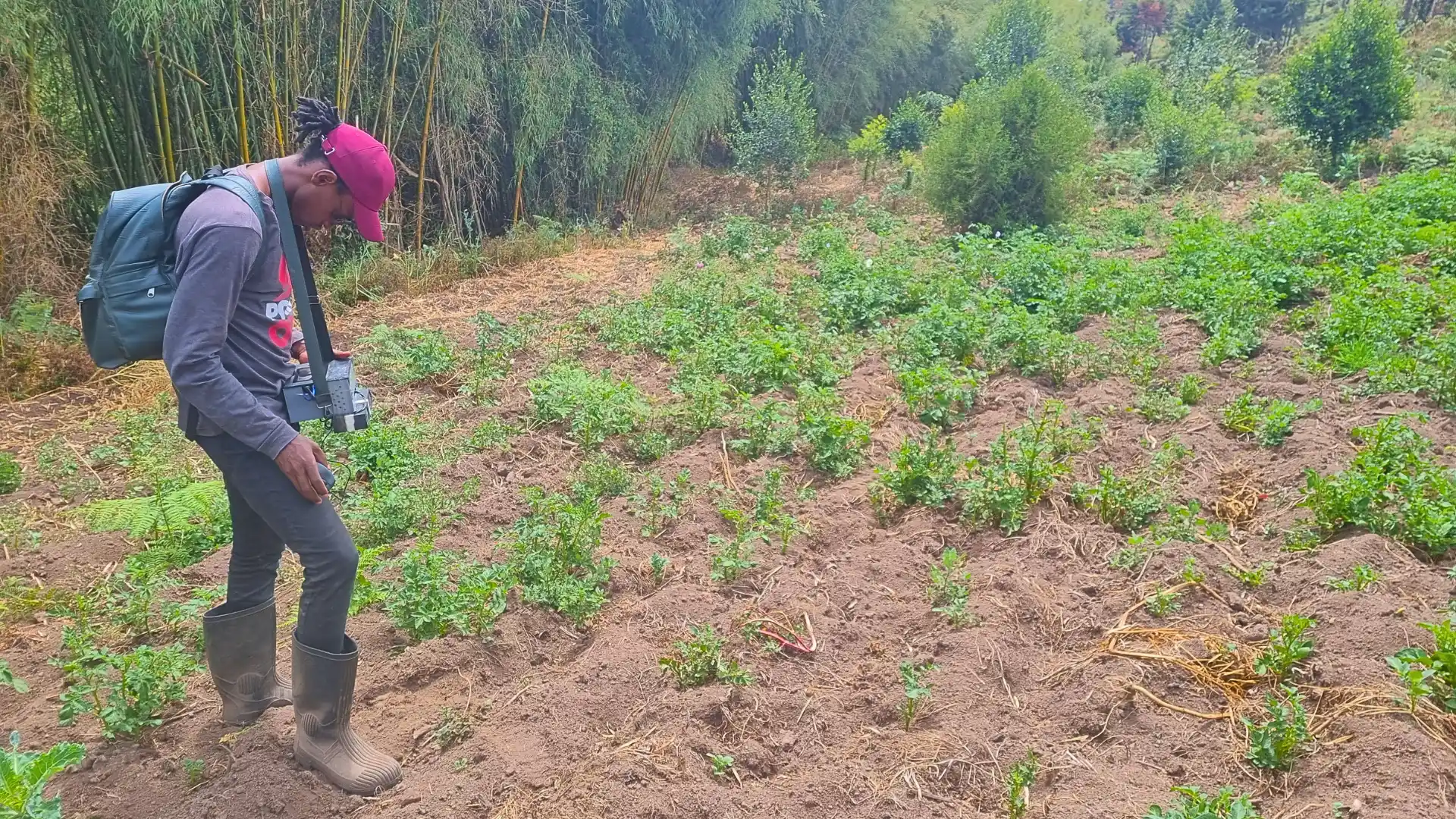
Figure 3: Fusion in action
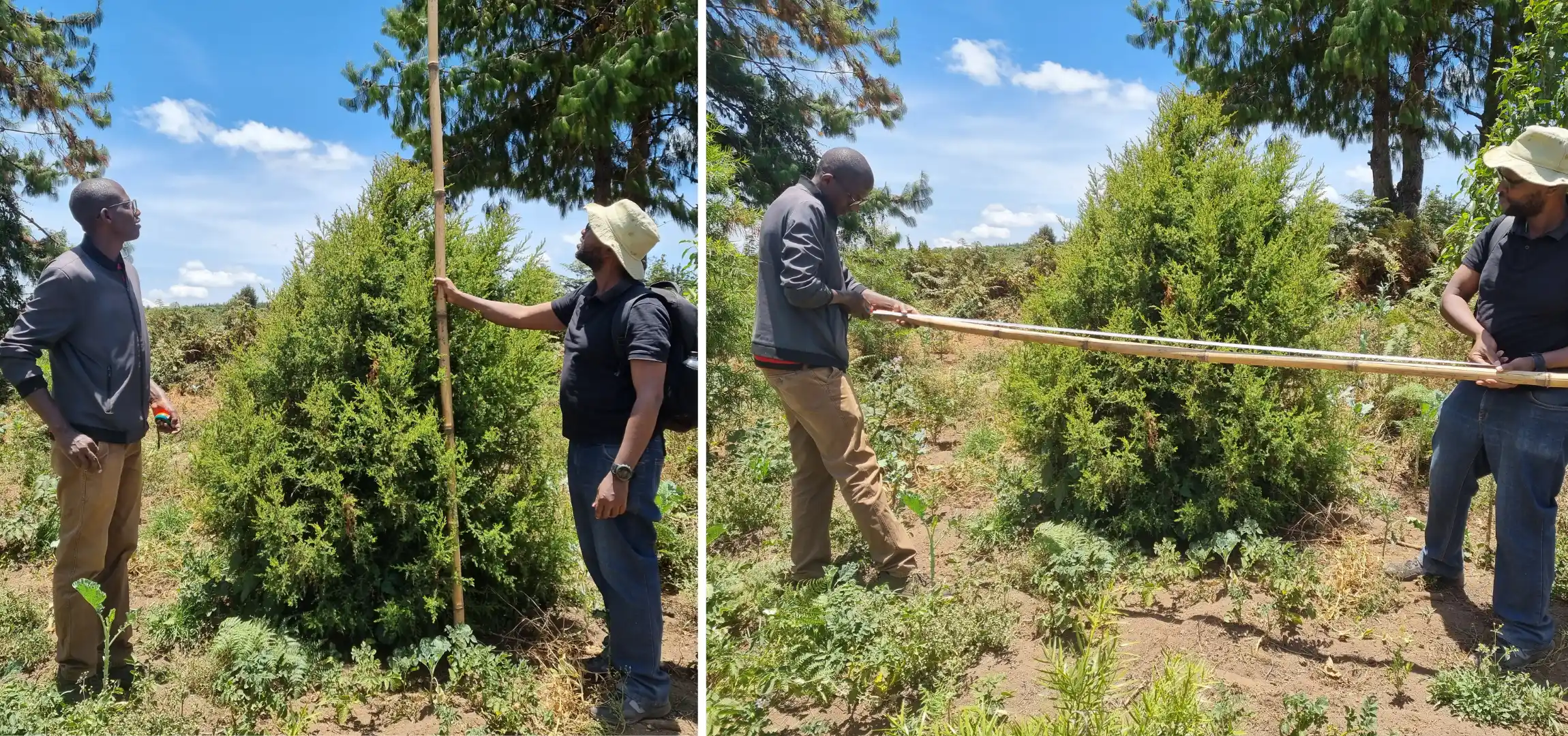
Figure 4: Ground Truth measurements
Well, apart from the adventures of hiking, cracking dry jokes along the way, and riding behind pickup trucks because no car of ours was going to be subjected to the torture of forest roads again, why else did we do this? The short answer is monitoring. The long answer is that these efforts were put in place after Safaricom PLC reached out to us to help them quantify their reafforestation efforts which aim to plant five million trees by 2025 in order to rehabilitate 5 hectares of degraded forest land and Kieni forest, to us, is ground zero.
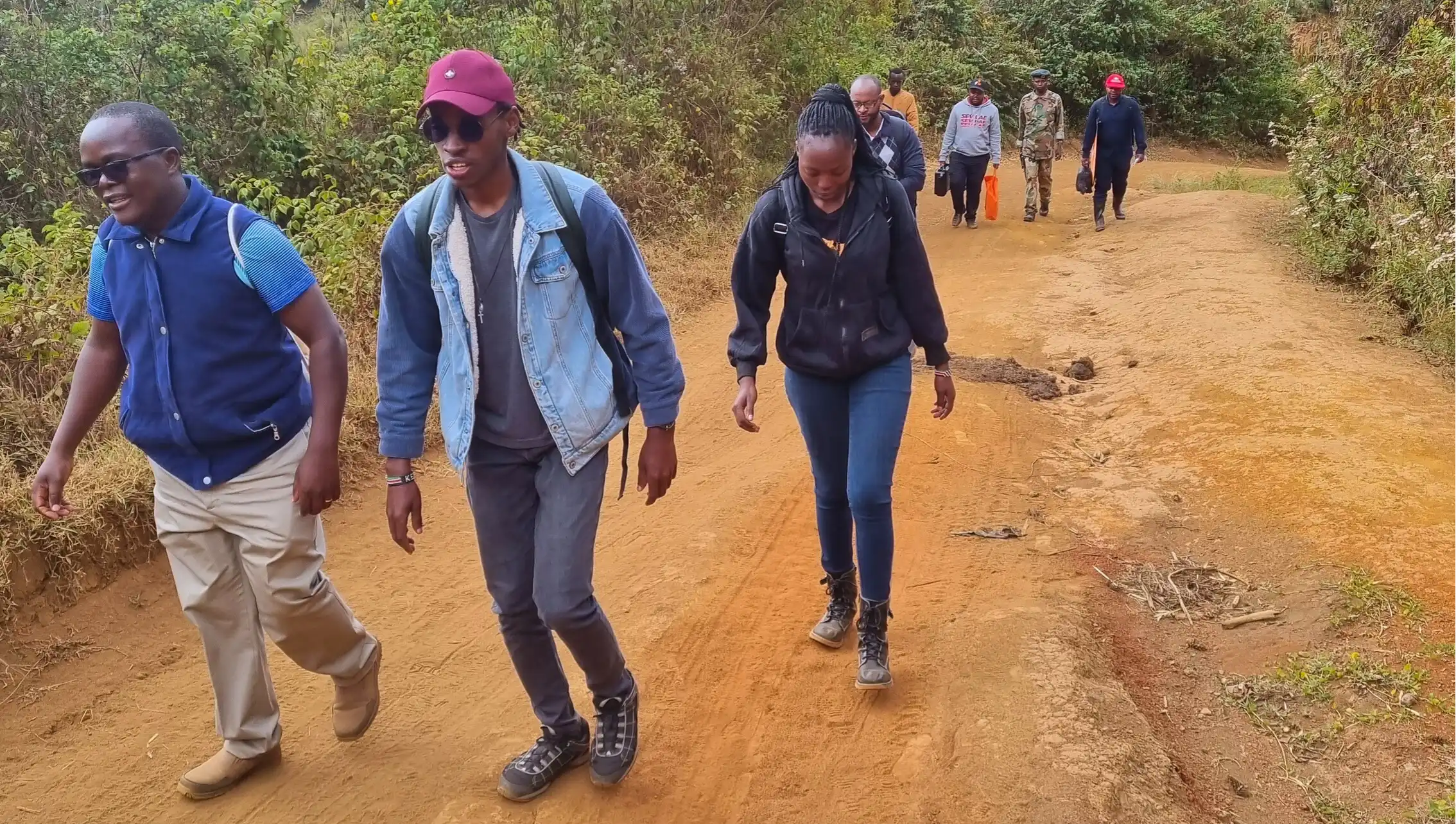
Figure 5: The Hike
In conclusion, this was a really productive and exciting exercise. We are cleaning and analyzing the data we collected. We hope that this system will be a useful tool in monitoring and conservation efforts as it helps make the process a lot more endearing to the foresters.
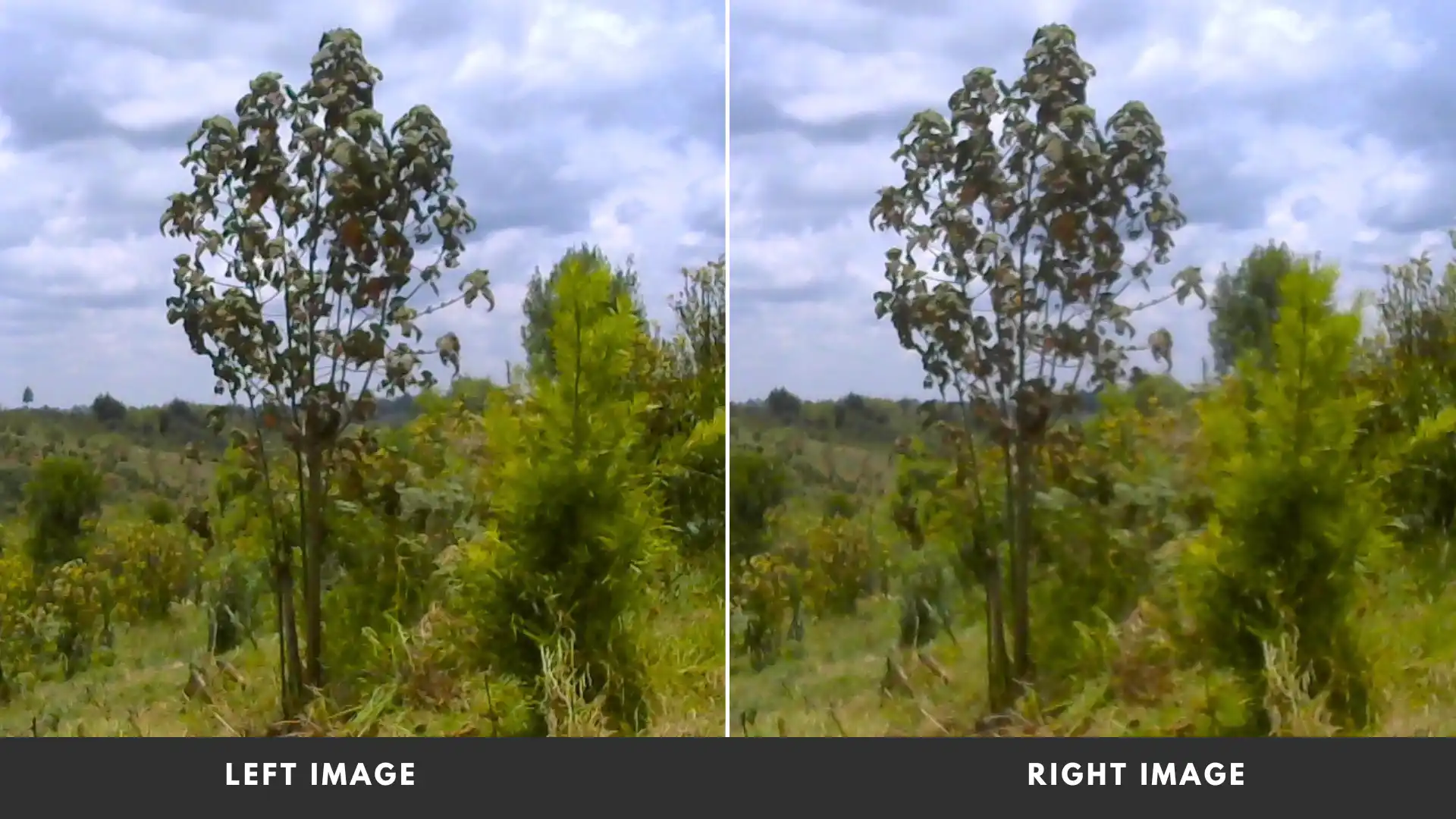
Figure 6: Stereoscopic image sample
Conclusion
We managed to sample a sizeable chunk of the 400 acres and while at it we met a lot of interesting people who farm in the forest, one of whom was able to turn his life around by choosing to become a farmer instead of the alternative (which I will not mention here). Despite the elephant’s attacks (yes, elephant’s attacks) and the biting drought, he still chooses farming. It’s his first year on the job, he is his own boss now, he reaps what he sows and a big chunk of profit while at it and he doesn’t want to go back, it seems his life is set on the right course. In retrospect, perhaps that was also a very useful piece of data to collect!